

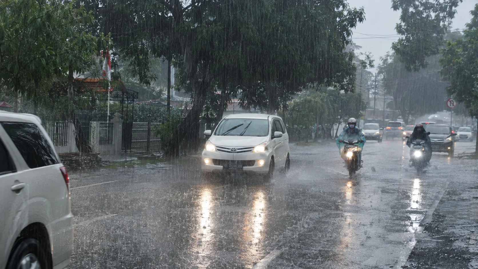
JAKARTA, JurnalPost.com - The Meteorology, Climatology, and Geophysics Agency (BMKG) has issued an early warning for extreme weather in several parts of Indonesia on Monday (9/11/2026). The public is urged to remain vigilant against the potential for heavy to extreme rainfall, which may be accompanied by lightning and strong winds in the coming days.
Based on the BMKG weather forecast for the period of 9–12 November 2026, North Sumatra is categorized as High Alert for the potential of very heavy to extreme rainfall. Meanwhile, Aceh and West Sumatra are in the Alert category for potential heavy rainfall.
This warning is significant because high-intensity rainfall poses a risk of flooding, waterlogging, and landslides, particularly in areas with limited drainage systems or hilly terrain.
In addition to heavy rain, the BMKG has also identified South Papua as a region that needs to be wary of potential strong winds during this period.
However, a provincial-level warning status does not mean that all regencies and cities will experience extreme weather simultaneously. Weather conditions can vary between regions and change according to atmospheric developments.
List of Regions with Potential for Heavy Rain from 9–12 November 2026
In the latest weather outlook published on 6 November 2026, the BMKG categorized the potential for extreme weather based on alert levels.
For the period of 9–12 November 2026, the regions receiving special attention include:
High Alert (very heavy to extreme rain): North Sumatra.
Alert (heavy rain): Aceh and West Sumatra.
Potential for strong winds: South Papua.
Outside of these regions, moderate-intensity rainfall is also expected in several other areas.
In Java, the potential for moderate rain covers Banten, West Java, Central Java, the Special Region of Yogyakarta, and East Java.
Meanwhile, in Kalimantan, there is a chance of moderate rain in West Kalimantan, Central Kalimantan, East Kalimantan, North Kalimantan, and South Kalimantan.
Other regions that need to monitor weather developments include Riau, Riau Islands, Jambi, South Sumatra, Bengkulu, Lampung, North Sulawesi, Gorontalo, West Sulawesi, North Maluku, and several provinces in Papua.
It should be noted that the moderate rainfall potential category differs from the High Alert or Alert status. The public is still advised to check detailed weather information specific to their respective locations.
Extreme Rainfall Recently Occurred in East Java and Bali
The latest BMKG warning follows reports of very high-intensity rainfall in several parts of Indonesia at the beginning of November.
In the monitoring report for the period of 1–4 November 2026, the BMKG recorded daily rainfall reaching 358 millimeters in East Java. Meanwhile, Bali recorded 300 millimeters, Aceh 167 millimeters, and West Kalimantan 101 millimeters.
Heavy rain was also observed in North Sumatra, Bengkulu, South Sulawesi, South Papua, West Sumatra, and West Sulawesi.
During the same period, wind speeds reached 35 knots in Lampung. Reports of strong winds were also recorded in Central Java and South Kalimantan.
This data indicates that high-intensity rainfall can still occur locally, even though parts of Indonesia are experiencing hot conditions and limited rainfall.
Why Does Heavy Rain Still Occur During El Niño?
The BMKG explained that atmospheric conditions in Indonesia at the beginning of November 2026 were still influenced by the El Niño phenomenon with very strong intensity and a positive Indian Ocean Dipole (IOD).
Based on monitoring up to the third ten-day period of October 2026, both phenomena generally tend to reduce the formation of rain clouds in parts of Indonesia.
However, the influence of regional and local atmospheric dynamics can still support the growth of rain clouds.
This situation causes non-uniform weather conditions. Some regions experience heavy rain, while others still face hot temperatures and drought.
The BMKG also noted that 543 observation points are in the category of very long to extremely long days without rain.
This condition increases the need for vigilance against forest and land fires, especially in areas experiencing prolonged drought.
In its official advisory, the BMKG stated, "The public and local governments are urged to conserve water and increase vigilance against the threat of drought and forest and land fires."
High Wave and Tidal Flood Warnings
In addition to land weather, the BMKG has issued high-wave warnings for several Indonesian waters.
For the period of 9–12 November 2026, waves with heights of 1.25 to 2.5 meters have the potential to occur in several water areas, including the Indian Ocean south of Java and Bali, the North Natuna Sea, and several waters around Maluku and Papua.
The BMKG also forecasts high-category waves, specifically 2.5 to 4 meters, in the southern part of the Lombok Strait for the period of 9–12 November. A similar warning applies to the waters west of Siberut, Sipora, and Pagai until the night of 9 November.
Fishermen, small boat operators, and people engaging in coastal activities should monitor wave developments and wind speeds before traveling.
On the other hand, the new moon phase on 9 November 2026 has the potential to increase maximum sea levels.
Based on BMKG tidal analysis, coastal flooding or tidal floods have the potential to occur in several areas, including the coast of North Jakarta, parts of the West Java coast, Riau, Bali, and East Nusa Tenggara.
The timing and impact level of tidal floods may vary in each region according to local tidal conditions.
BMKG Reminds the Public to Monitor the Latest Weather Warnings
Facing the potential for extreme weather, the public is advised to prepare anticipatory measures early, especially if they live in areas with a history of flooding or landslides.
Residents in flood-prone areas should ensure that water channels are not clogged. Meanwhile, those living near slopes should increase their vigilance when heavy rain occurs for a long time.
Motorcyclists also need to be careful of slippery roads, puddles covering potholes, and reduced visibility when it rains.
If rain is accompanied by lightning, activities in open fields, under tall trees, or in areas at risk of being struck by lightning should be temporarily stopped.
The BMKG provides short-term early warning information or nowcasting to help the public understand weather developments within the next six hours.
Because forecasts and warning statuses can change, the public needs to follow official BMKG updates according to their respective provinces, regencies, or districts.
The BMKG early warning on 9 November 2026 serves as a reminder that the potential for extreme rain, strong winds, high waves, and drought can occur in close proximity in different regions. Vigilance based on local conditions is an important step to reduce the risk of disasters due to weather changes.






Comments 0
Write a Comment Share your response